| ||||
| Introduction | Below you will find various documents and mapping resources about Lasqueti Island that we have found in our explorations on the Internet. | |||
| Preview | Description | |||
|
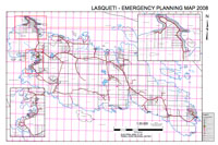
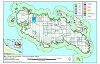
2008 Powell River Regional District Emergency Planning Map (Link checked on 2011-10-29) Cadastral survey of Lasqueti Island, with property owner information from land title records. | |||
|
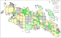
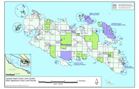
2008 Islands Trust Build-out Map (Link checked on 2011-10-29) Cadastral survey of Lasqueti Island, with property boundaries, ALR boundaries, crown land, parks, and maximum subdivisions permitted. | |||

|
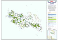
Integrated Land Management Bureau Terrestrial Ecosystem Mapping (Link checked on 2011-10-29) Map of different ecosystems on Lasqueti Island Coastal Douglas-fir Zone. | |||
|
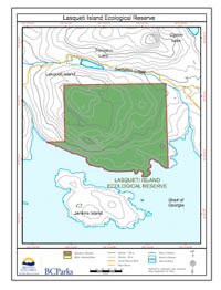
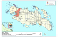
Lasqueti Island Ecological Reserve (Link checked on 2011-10-29) Map of the boundaries of the Lasqueti Island Ecological Reserve, south of Mt. Trematon. | |||
|
Lasqueti Island Dry Soil Ecosystems - Draft (Link checked on 2011-10-29) Islands Trust Map of dry soil ecosystems on Lasqueti Island. | |||
|
Lasqueti Island Wet Soil Ecosystems - Draft (Link checked on 2011-10-29) Islands Trust Map of wet soil ecosystems on Lasqueti Island. | |||

|
Lasqueti Island Forest Ecosystems - Draft (Link checked on 2011-10-29) Islands Trust Map of forest ecosystems on Lasqueti Island. | |||
|
Lasqueti Island (East) Sensitive Ecosystem Mapping Airphoto - 2003 and 2007 (Link checked on 2011-10-29) Islands Trust Map of sensitive ecosystems for East Lasqueti Island. | |||
|
Lasqueti Island (West) Sensitive Ecosystem Mapping Airphoto - 2003 and 2007 (Link checked on 2011-10-29) Islands Trust Map of sensitive ecosystems for West Lasqueti Island. | |||
|
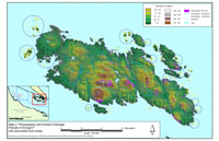
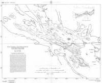
Physiography and Surface Drainage (Link checked on 2011-10-29) Islands Trust Map of elevation, steep slopes and rivers on Lasqueti Island. | |||
|
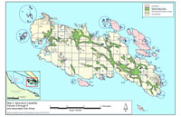
Lasqueti Island Crown Land Context (Link checked on 2011-10-29) Islands Trust Map of crown land and protected land on and near Lasqueti Island. | |||
|
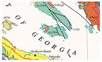
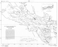
Lasqueti Island Geology (Link checked on 2011-10-29) Islands Trust Map of the geology Lasqueti Island. | |||
|
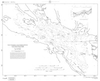
Lasqueti Island Agriculture Capability (Link checked on 2011-10-29) Islands Trust Map of the agriculture capability of Lasqueti Island. | |||
|
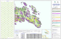
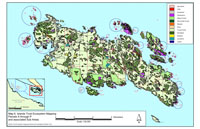
Lasqueti Island Ecosystem Mapping (Link checked on 2011-10-29) Islands Trust Map of ecosystems on Lasqueti Island. | |||
|
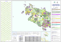
Lasqueti Island Rural Land Use Bylaw - Land Use and Water Zoning (Link checked on 2011-10-29) Islands Trust Map zoning and rural land use. | |||
|
Southern British Columbia Geological Map (Link checked on 2011-10-29) Map of the surface geology of Southern British Columbia. | |||

|
Islands Trust Area (Link checked on 2011-10-30) Map of the areas governed by the Islands Trust. | |||
|
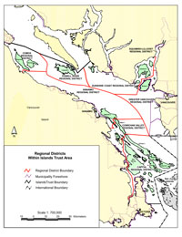
Regional Districts within Islands Trust Area (Link checked on 2011-10-30) Map of the regional districts that include land governed by the Islands Trust. Lasqueti is within the Powell River Regional District. | |||

|
Federal Electoral Districts within Islands Trust Area (Link checked on 2011-10-30) Map of the federal electoral districts that include land governed by the Islands Trust. Lasqueti is within the Nanaimo - Alberni electoral district. | |||

|
Provincial Electoral Districts within Islands Trust Area (Link checked on 2011-10-30) Map of the provincial electoral districts that include land governed by the Islands Trust. Lasqueti is within the Nanaimo - Parksville electoral district. | |||
|
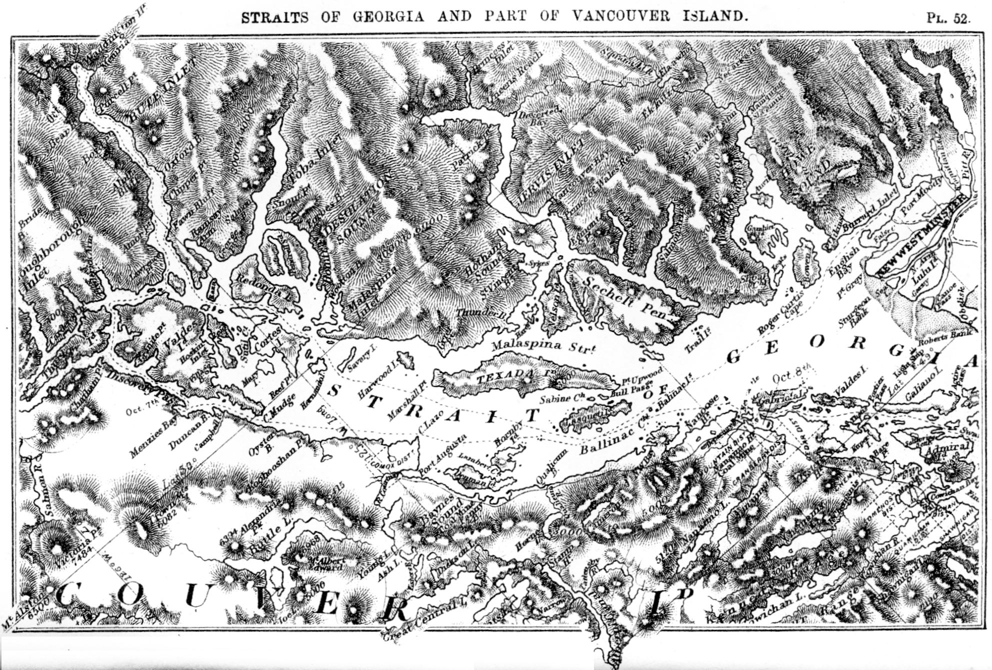
Straits of Georgia and Part of Vancouver Island (Link checked on 2011-10-30) Historical mapping of the Straits of Georgia from a book published in 1873. | |||
|
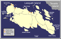
Beach Access Map of Lasqueti (Link checked on 2011-12-16) Road and beach access map from the "Gulf Island Guide". | |||

|
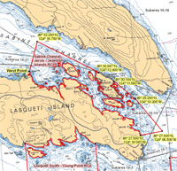
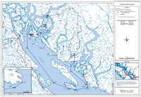
South Lasqueti Rockfish Conservation Area (Link checked on 2011-12-16) Rockfish Conservation Areas - Pacific Region Area 14 - Lasqueti Island South - Chart 3512, from the Department of Fisheries and Oceans. | |||
|
North Lasqueti Rockfish Conservation Area (Link checked on 2011-12-16) Rockfish Conservation Areas - Pacific Region Area 16 - Sabine Channel - Jervis - Jedediah Islands - Chart 3512, from the Department of Fisheries and Oceans. | |||
|
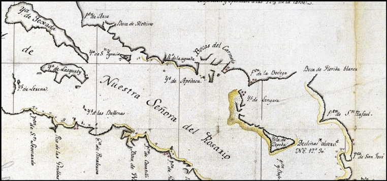
Carta que comprehende (Link checked on 2011-12-16) Ya de Lasquety, as shown on chart prepared by cartographer of the original Spanish expedition that first surveyed the Salish Sea. More historical information can be found on Gary Little's article on Jose Maria Narvaez. | |||
|
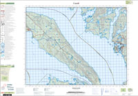
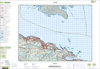
092F09 Topographic Map (Link checked on 2011-12-16) An older topo map covering North Lasqueti and Texada Islands. | |||

|
092F08 Topographic Map (Link checked on 2011-12-16) An older topo map covering South Lasqueti and Parksville. | |||
|
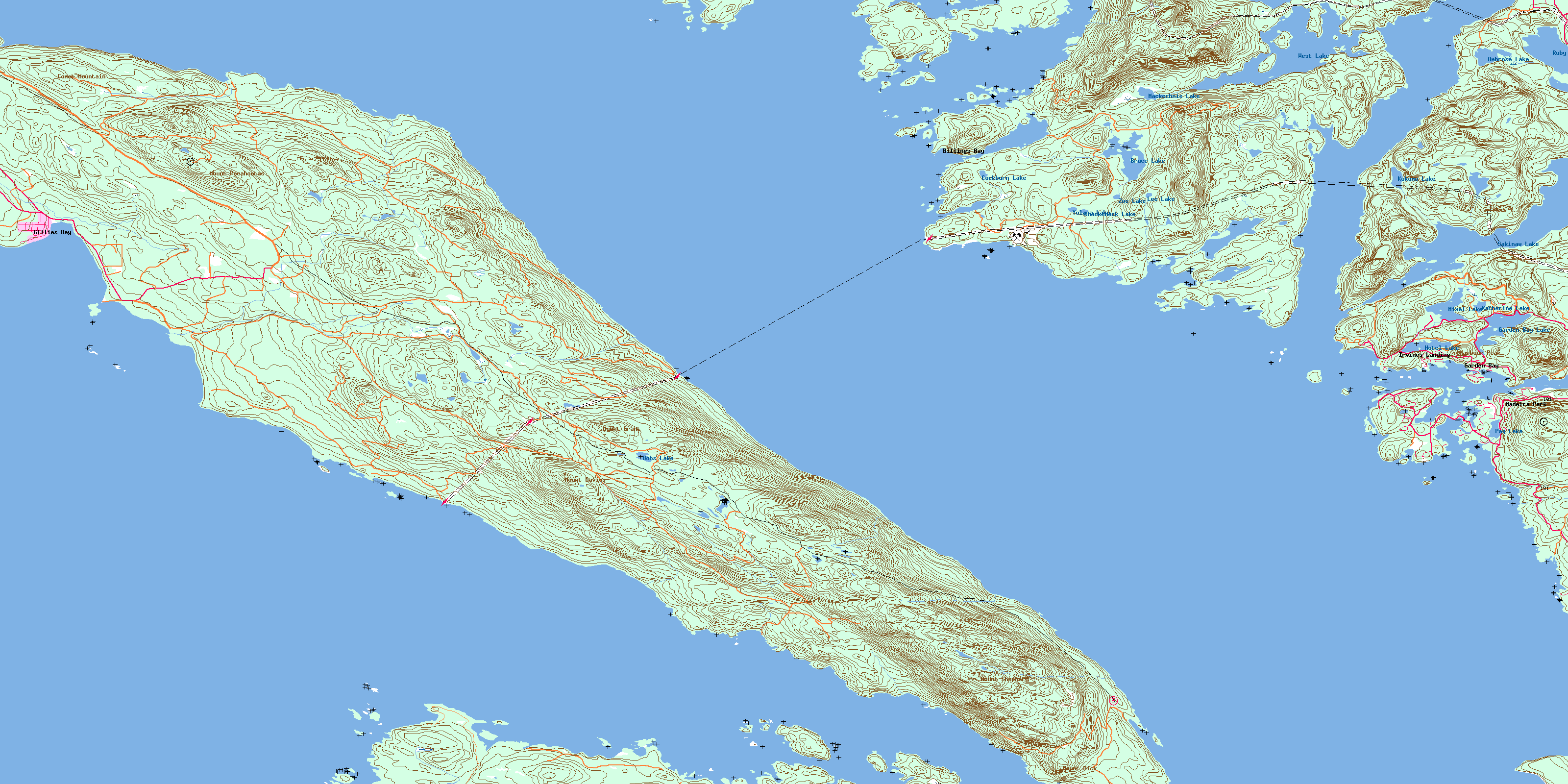
092F09 Topographic Map (Link checked on 2011-12-16) A newer (2009) topo map covering North Lasqueti and Texada Islands. | |||
|
092F08 Topographic Map (Link checked on 2011-12-16) A newer (2009) topo map covering South Lasqueti and Parksville. | |||
|
Tla'amin Fishing Area (Link checked on 2012-01-14) A map of the treaty fishing areas for the Tla'amin First Nation. | |||
|
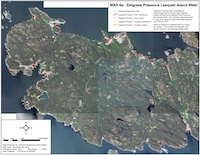
Eelgrass Presence Lasqueti Island West (Link checked on 2013-04-01) Eelgrass on western Lasqueti Island. | |||
|
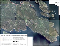
Eelgrass Presence Lasqueti Island East (Link checked on 2013-04-01) Eelgrass on eastern Lasqueti Island. | |||
|
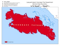
Lasqueti Island Volunteer Fire Department Service Boundary (Link checked on 2013-04-01) Area of Lasqueti Island that is served by the local volunteer fire department (basically the whole island). | |||
|
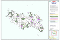
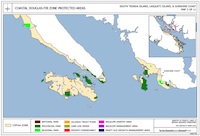
Coastal Douglas Fir Protected Areas (Link checked on 2013-04-01) Map of protected areas on Lasqueti Island. See map 3 of 11. | |||

|
Biogeoclimatic Ecosystem Classification Subzone/Variant Map for the Sunshine Coast Forest District Coast Forest Region (FTP) (Link checked on 2013-04-01) Forest ecosystem mapping. Lasqueti Island is wholly "Coastal Douglas Fir". | |||
|
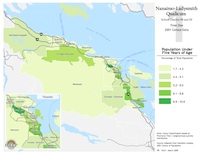
Socio-Economic Status Mapping for Early Child Development (Link checked on 2013-04-01) Census heat maps showing factors that influence child development. Includes 25 maps. Information derived from Statistics Canada and the 2001 Canadian Census. | |||
|
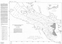
Seismic Stratigraphy of Unconsolidated Sediments in the Central Straight of Georgia: Hornby Island to Roberts Bank (Link checked on 2013-04-01) Seismic tracklines for seismic profiles. Indicates where seismic data was collected in order to generate the subsequent maps. | |||
|
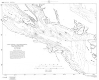
Seismic Stratigraphy of Unconsolidated Sediments in the Central Straight of Georgia: Hornby Island to Roberts Bank (Link checked on 2013-04-01) Bathymetry of the modern seafloor. Used for comparison with the calculated historic seafloors. | |||
|
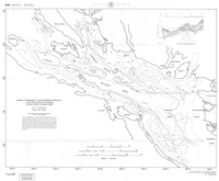
Seismic Stratigraphy of Unconsolidated Sediments in the Central Straight of Georgia: Hornby Island to Roberts Bank (Link checked on 2013-04-01) Geological mapping of the morphology of the sea floor during the early to mid Holocene. | |||

|
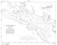
Seismic Stratigraphy of Unconsolidated Sediments in the Central Straight of Georgia: Hornby Island to Roberts Bank (Link checked on 2013-04-01) Geological mapping of the morphology of the sea floor during the late Wisconsinan. | |||
|
Seismic Stratigraphy of Unconsolidated Sediments in the Central Straight of Georgia: Hornby Island to Roberts Bank (Link checked on 2013-04-01) Geological mapping of the morphology of the sea floor during the late Tertiary and Quaternary. | |||
|
Seismic Stratigraphy of Unconsolidated Sediments in the Central Straight of Georgia: Hornby Island to Roberts Bank (Link checked on 2013-04-01) Geological mapping of the morphology of the sea floor, delta deposits and muds. | |||
|
Seismic Stratigraphy of Unconsolidated Sediments in the Central Straight of Georgia: Hornby Island to Roberts Bank (Link checked on 2013-04-01) Geological mapping of sediment fill from previous periods of glaciation and erosion events. | |||

|
Seismic Stratigraphy of Unconsolidated Sediments in the Central Straight of Georgia: Hornby Island to Roberts Bank (Link checked on 2013-04-01) Geological mapping of ice eroded facies. | |||
|
Seismic Stratigraphy of Unconsolidated Sediments in the Central Straight of Georgia: Hornby Island to Roberts Bank (Link checked on 2013-04-01) Geological mapping of complete unconsolidated sediments. | |||
|
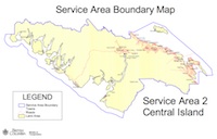
Ministry of Transportation Service Area Boundary Map (Link checked on 2013-04-01) Area serviced by the "Service Area 2" region. | |||
|
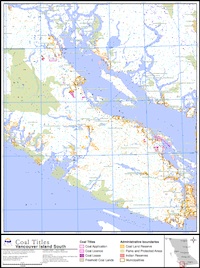
Coal Titles - Vancouver Island South (Link checked on 2013-04-01) Coal titles in southern Vancouver Island. | |||
|
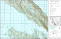
Map 092F059 (Link checked on 2013-04-01) Northern Lasqueti Island. | |||
|
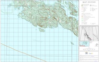
Map 092F049 (Link checked on 2013-04-01) West Lasqueti Island. | |||
|
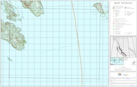
Map 092F050 (Link checked on 2013-04-01) South Lasqueti Island. | |||
|
Last Updated on: 2014-10-18 | ||||